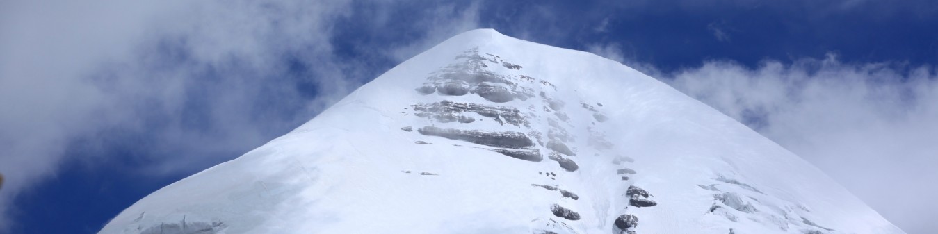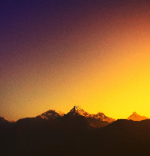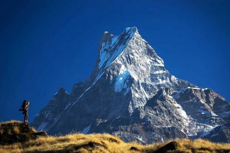
5,416m/17,769ft
MAX-ALTITUDEKaski, Nepal
LOCATIONGROUP-SIZE
Minimum 02DIFFICULTY
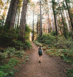
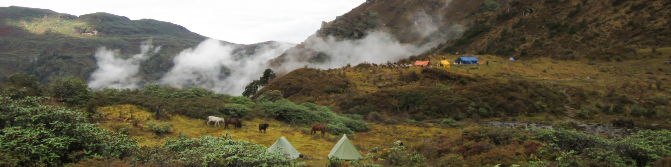
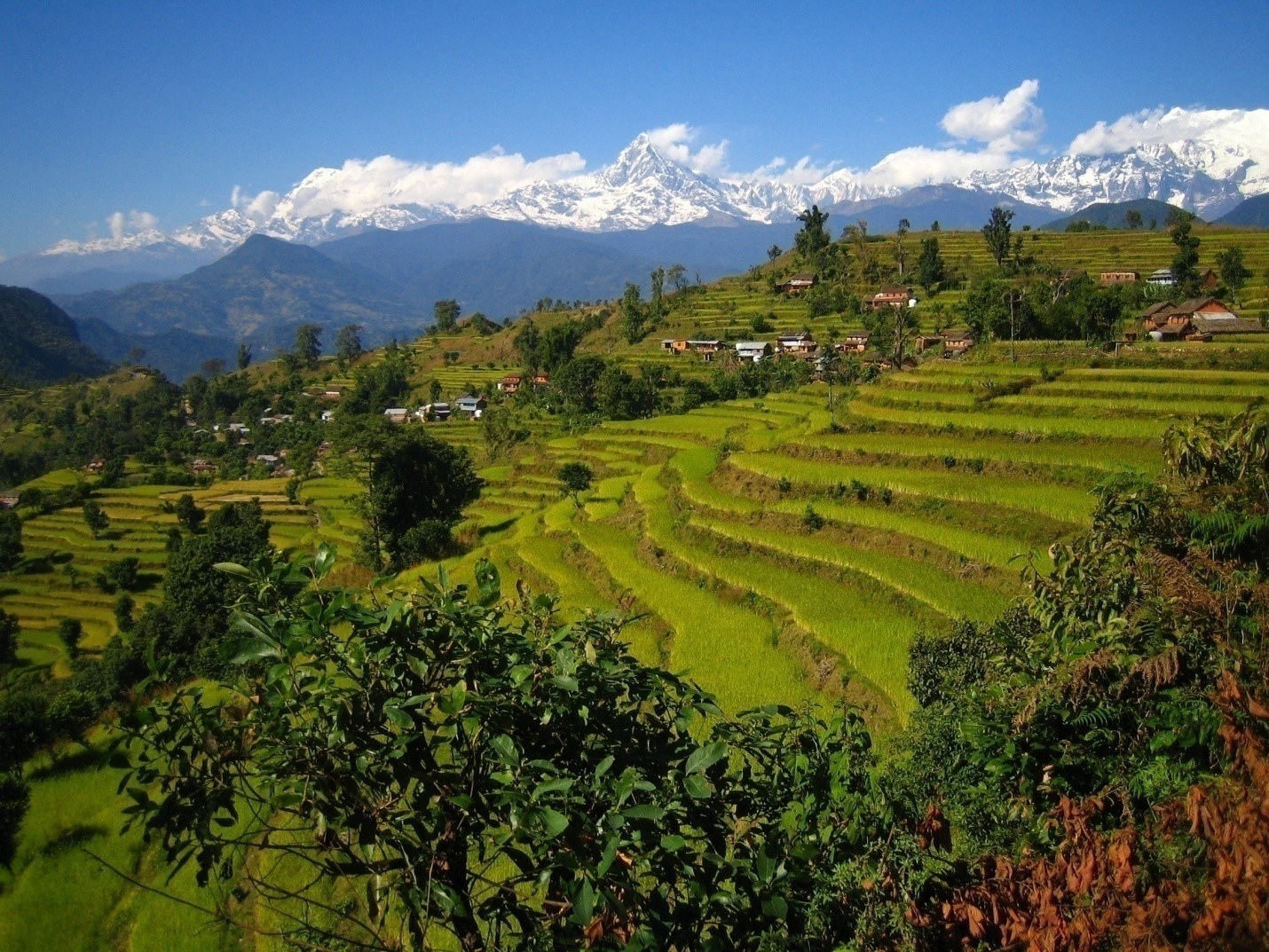
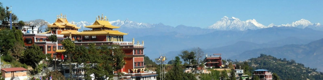
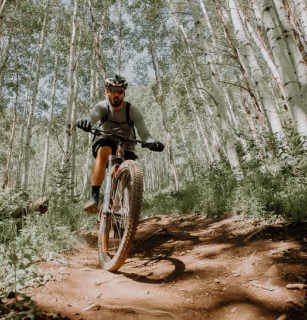
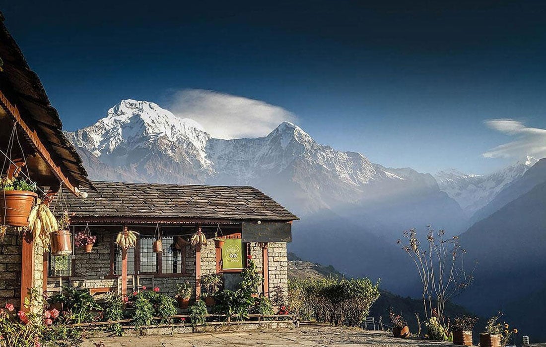
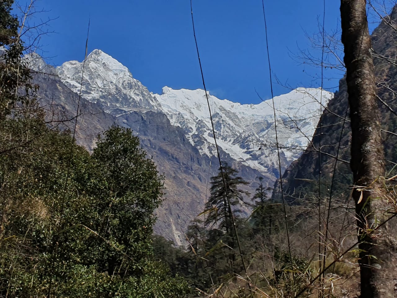
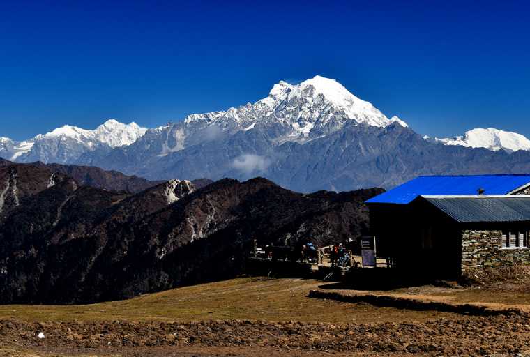
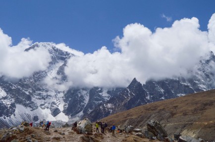
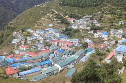
ModerateThis trek passes through the world’s deepest kali Gandaki gorge with Annapurna in east, Dhaulagiri in west. Stunning mountain views from poon hill offer the opportunity to discover diverse Annapurna region. Religious, Cultural and pilgrimage heritage of this adds more charms for trekkers in this region. Trekkers who prefer short trek, there is a customize itinerary options as well short trek like Annapurna base Camp trek and poon hill trek in the same region.
Itinerary
Day 01
Arrival in Kathmandu (1,400 m / 4,592 ft.)
Upon arrival in Katmandu’s Tribhuvan International Airport, meet, assist and transfer to hotel for room check in. Rest of the day till dinner is free. Eve: Welcome dinner at Authentic Nepali restaurant with culture program.
Overnight at hotel in Kathmandu.
Day 02
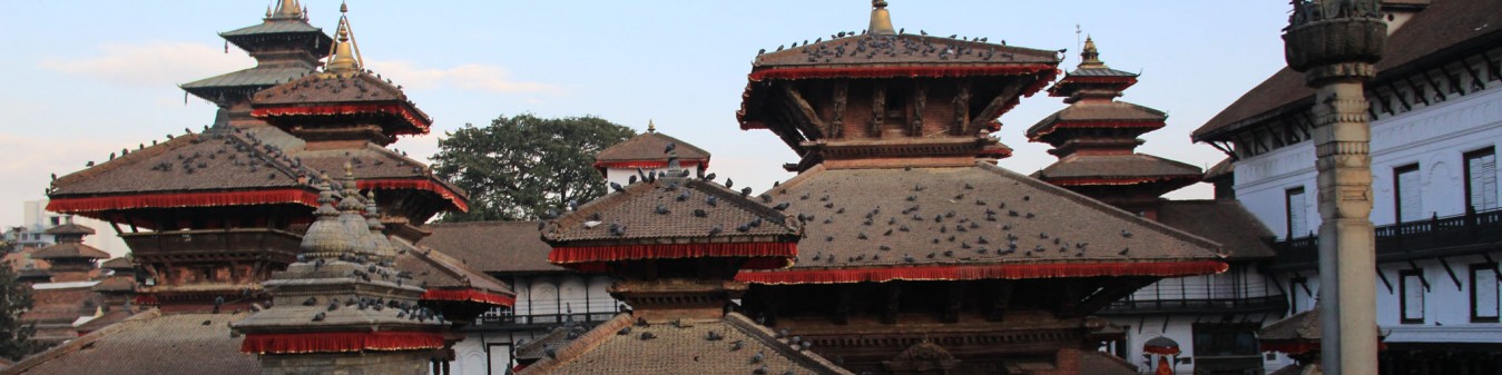
Sightseeing tour and orientation in Kathmandu (1,400 m / 4,592 ft.)
After breakfast, proceed for a full day sightseeing tour of Kathmandu City. After sightseeing tour transfer to hotel. After short refreshment there will be a short briefing and orientation about the trek. Rest of the day if free for rest and final preparation of trek.Dinner and overnight at hotel.
Day 03
Drive to Besi Shahar (760 m / 2,490 ft) - 187 kms.
After breakfast, check out from and start scenic drive to Beshi Sahar. En route lunch stop at Kuringtar Spring Resort. After a hearty lunch in Kuringtar continue drive to Besi Shahar continue drive to Besi Sahar (823 m) which is the main town of Lamjung district. Until recently this market town of 2000 inhabitants was called Besigaon. However since the opening of the road to Manang, in the late seventies, there are several administrative offices here, as well as post-offices and a police check-post where your trekking permit will be examined for the first time.
Dinner and overnight at lodge in Besi Shahar.
Day 04
After breakfast, check out from and start scenic drive to Beshi Sahar. En route lunch stop at Kuringtar Spring Resort. After a hearty lunch in Kuringtar continue drive to Besi Shahar continue drive to Besi Sahar (823 m) which is the main town of Lamjung district. Until recently this market town of 2000 inhabitants was called Besigaon. However since the opening of the road to Manang, in the late seventies, there are several administrative offices here, as well as post-offices and a police check-post where your trekking permit will be examined for the first time. Dinner and overnight at lodge in Besi Shahar.
We start by heading northwards, until we reach District Forest Office. Then ascend for 150 meters, heading towards Pam Khola on the other side of the small bridge. The track goes up again till the hamlet of Sanuti, less than thirty minutes away. Walk across fields of paddy, barley and corn to reach the village of Bhalam in about an hour’s time.
Then we cross Khudi Khola on a suspension bridge to reach the first Gurung village also named Khudi (792m). It takes about two and half hours to reach the Nagadi village (860m) from Khudi. From Nagdi village, we start by moving north up to a suspension bridge crossing the Nagdi Khola. At this point, the track on the right leads to the village of Utsa. The path going up towards Marsyangdi leads to the village of Lampata in the Manang District. The climb is quite steep and it takes about two hours to reach Bahundanda, a village sitting on the headline at a height of 1314 meters. Bahundanda means Brahman’s hill” which explains the origin of the people. We stop here for lunch and to enjoy the view of Mount Phungi (6379m), towards the North. After lunch at Bahundanda, climb down a steep slope for about thirty minutes until we reach the Dhule Khola, cross over to reach the village of Besi. In about an hour’s time we get to see the magnificent waterfall at Syange (1136m) flowing from the high plain hamlet of Ghulima.
Dinner and overnight at lodge in Syange.
Day 5
Trek to Tal (1,700 m / 5,576 ft) via Jagat – 7 hours.
After breakfast, descent down to Marshyangdi River and cross the suspension bridge, from here the trail climbs gently to reach Jagat, a village along the ridge at a height of 1340m. From Jagat it is a gentle walk until we reach
The hamlet of Sattare (‘top of the hill’, in Tibetan). From here we will again descent down to bridge over Marshyangdi River. After crossing over the river we walk, along the ridge of the hills and then uphill for about an hour through the bamboo forest, to reach the village of Tal set in the middle of the broad valley at a height of 1700 meters. Tal means ‘lake’ in Nepali language. Rest of the day is free for rest
Dinner and overnight at teahouse lodge.
Day 06
Trek to Koto (2,600 m / 8,528 ft) via Dharapani – 7 hours.
After breakfast, we will cross the suspension bridge over Marshyangdi River, from here it is about two hours to reach Dharapani (1943m), which means ‘stream’. Continue walk to Bagarchap (2,164 m). From here there is a steep climb up to the hamlet of Dhanagya (2,300 m), where we will stop for lunch, enjoying the view of Mt. Manaslu (8,163 m). After lunch it takes us about 2-½ hrs to 3 hrs through the hamlet of Thanchock and Besi Salla (which means “the Garden of Pines”) to reach Kodo (and also called Koto) meaning ‘Millet’
Dinner and overnight at Camp or Lodge in Kodo.
Day 07
Trek to Humde (3,280 m / 10,785 ft) via Pisang – 7 hours.
After breakfast we walk to the village of Kyupar (2,600m). Outside the village a police check post controls the access to the Nar Phu Khola Valley, which leads to Tibet. We have to show, our trekking permits here again before proceeding to Chame (2713m), the District Headquarters of Manang District, which is another 30 minutes away. From Chame, we walk along the river to reach the village of Bratang (2919m), mainly populated by Tibetans. From here we have to cross the Marshyagdi River one more time and climb up to Dhikur Pokhari through the dense pine forest. Here we stop for hearty lunch.
After lunch we have to go down to Pisang (3,185m), from here we crossed Pisang Khola there is a forty-five minutes steep climb up to a steep pass. From the top of the pass we get a glimpse of Paunda Danda (4655m), mount Pisang and Manang valley, with right before you Mount Tilicho. From here we descent down to Humde.
Dinner and overnight at lodge or Camp in Humde.
Day 08
Trek to Manang (3,530m / 11,580 ft) – 4 hours.
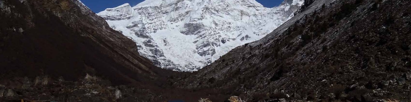
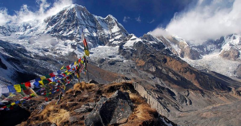
Once again we come across a check post where the trekking permits will be again examined. From Hongde the valley widens and we get to see the Annapurnas III and IV (7555m and 7525m) to the left, East and West Chulus (6584m and 6419m) on the right, towards the horizon there are views of highest peak of Mount Thorung(6481m) and to the east, the crown of Mount Pisang. From Hongde we climb upto the ancient village of Braga (3505m).
We can take time to wander around Braga to see this picturesque village with its flat roofed houses and to visit the Gompa, not only the largest in the region but also the richest with its fine collection of Thangkas (religious scroll paintings) and prayer books. After hearty lunch it takes only forty-five minutes to reach Manang from here, which sits on the plateau at 3530m. Dinner and overnight at teahouse lodge
Day 09
Rest day in Manang for acclimatization.
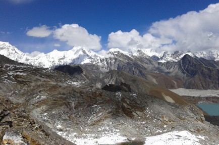
Rest day in Manang for acclimatization. Your guide will take you on a hike towards Gangapurna Glacier on this day for acclimatization process.
Dinner and overnight at teahouse lodge.
Day 10
Trek to Khangsar (3,650 m / 11,972 ft) – 4 hours.
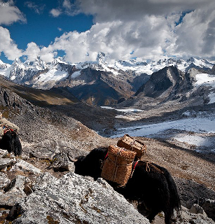
The Khangsar trail goes downhill to a chorten, then turn northwest and heads down towards the river. Stay on a north bank and head west, following a trail alongside the river. Follow the power lines along the ridge on a wide trail, then traverse along the south side of the ridge through a blue pine forest and cross the suspension bridge then climbs to meet the ridge.Khangsar is collection of traditional building surrounding a large village square. The top storey of each house has been whitewashed, but a complex web of power lines detracts somewhat from the picturesque aspect of the village.
Dinner and overnight at lodge or Camp.
Day 11
Trek to Churi Lader (4,200 m / 13,776 ft) - 4 hours
From Khangsar, the trail goes descending to Gungsang crossing Jharsang Khola. The route passes through sparse forests of Juniper, rose and barberry and a few meadows where horses and yaks graze of Chulu west and Gunndang then Mani wall in a meadow. Beyond is Yak Kharka, also known as Koche. Take lunch at Yak Kharka and continue to Churi Lader for overnight. Dinner and overnight at lodge or Camp.
Day 12
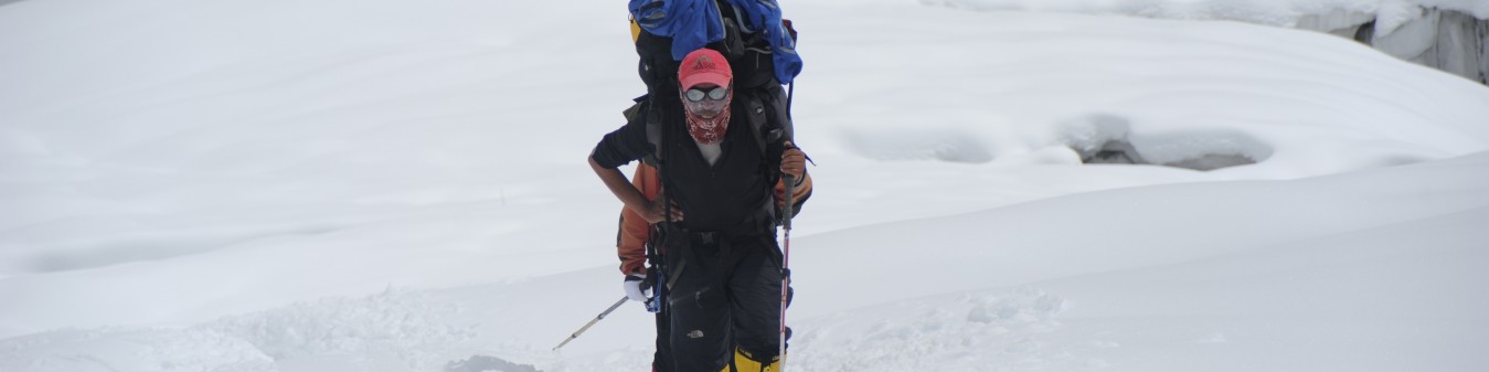
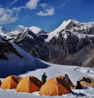
Trek to Thorung Phedi (4,450 m / 14,600 ft) & continue to High Camp (4,800 m / 15,745 ft) – 6 hours.
It normally takes about two hours to reach Thorung Phedi from Lattar, but owing to the high elevation we advise trekkers to walk slowly with frequent rests and water breaks in order to avoid getting sick at such an extreme elevation. Thorung Phedi means ‘foot of the hill’ and it is situated at a height of 4220m on a small hill overlooking a high plateau. After lunch at Thorung Phedi continue ascent for another 2 hours to the High Camp not because it is very high, but it is closer to Thorung La pass and saves trekkers appx 3~4 hours while crossing the main Thorung la pass the following day. Dinner and overnight at teahouse lodge.
Day 13
Contingency day!
Contingency day in the account of delay or for additional acclimatization.
Dinner and overnight at teahouse lodge / Camp.
Day 14
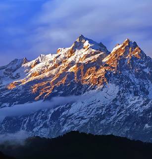
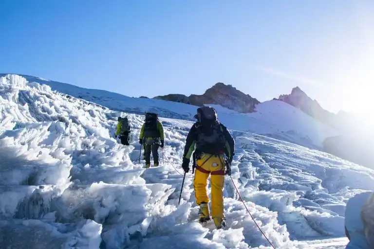
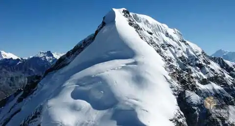
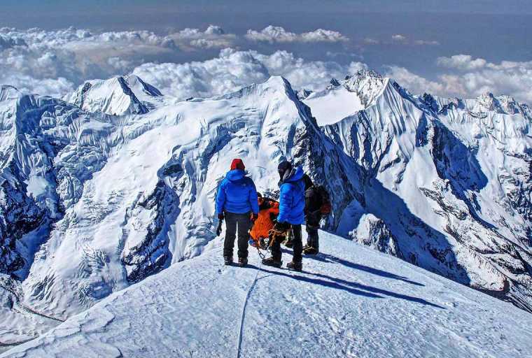
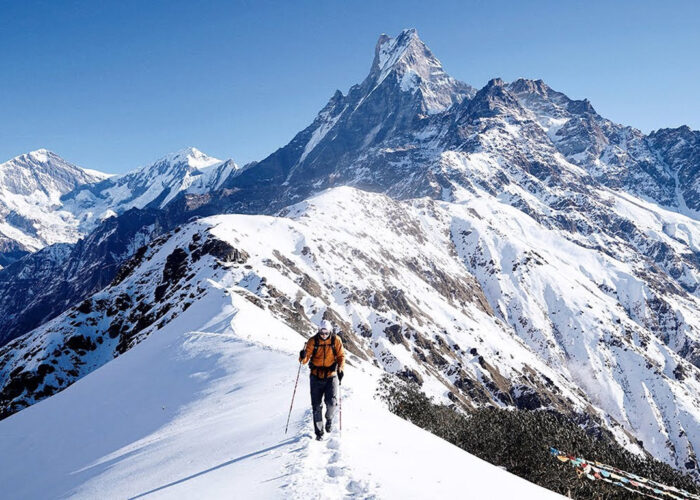
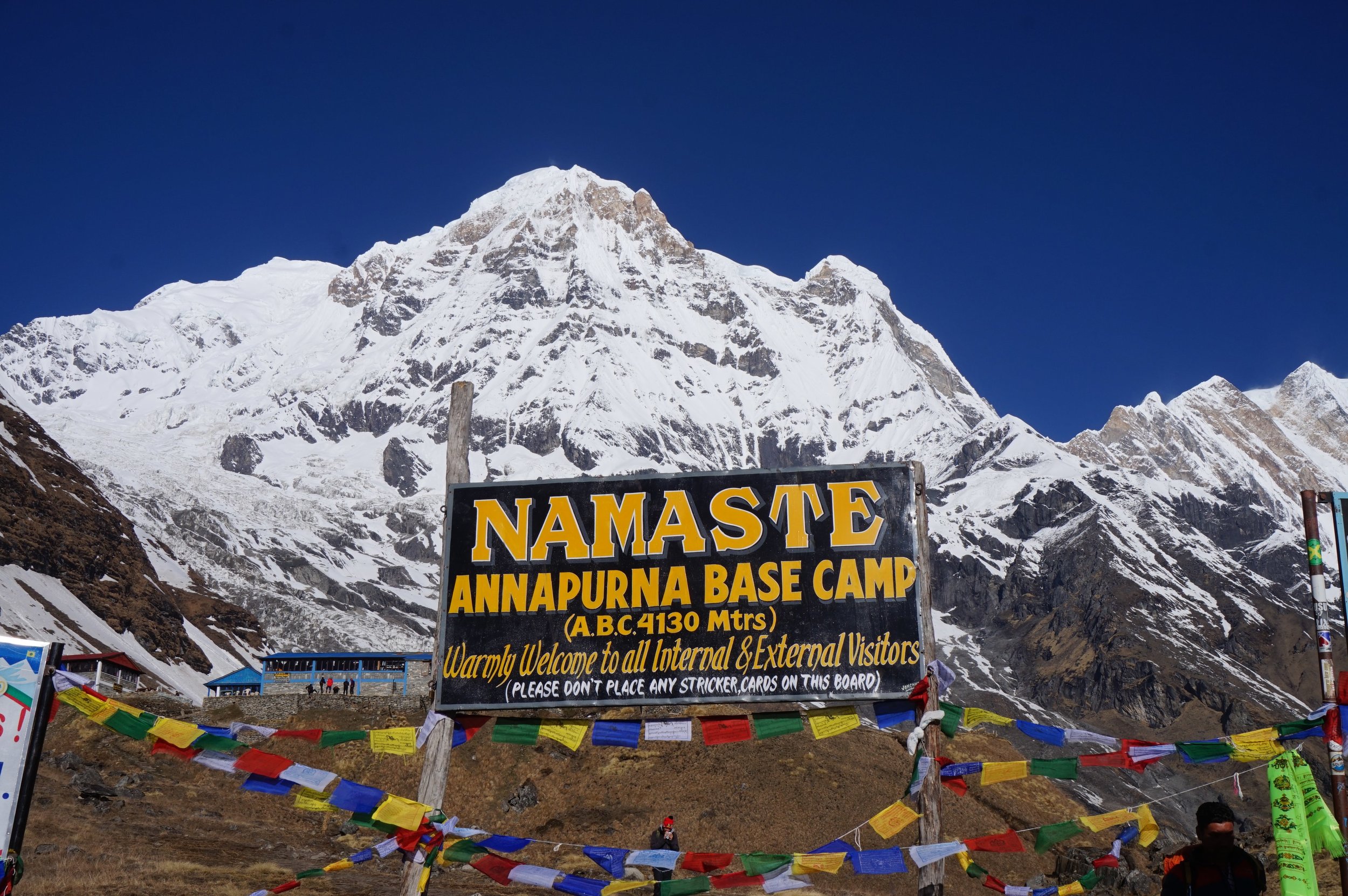
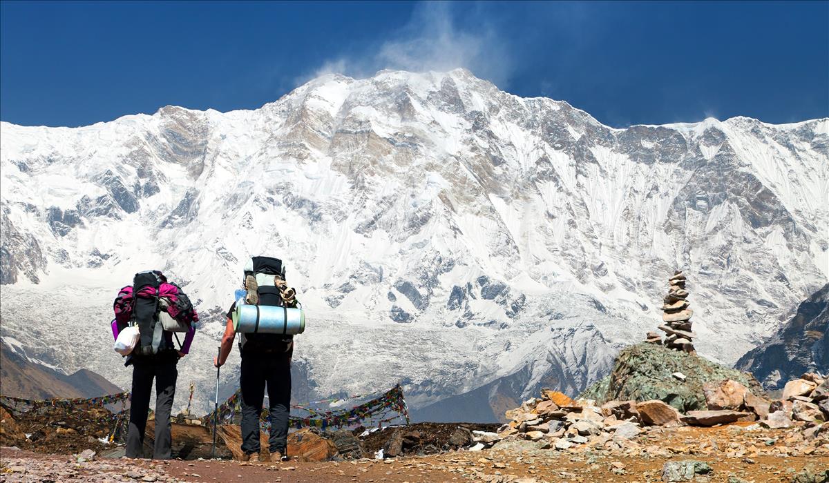
Trek over Thorung la pass (5,416m /17, 770 ft) and descend to Muktinath (3,802 m / 12,530 ft) – 8 hours.
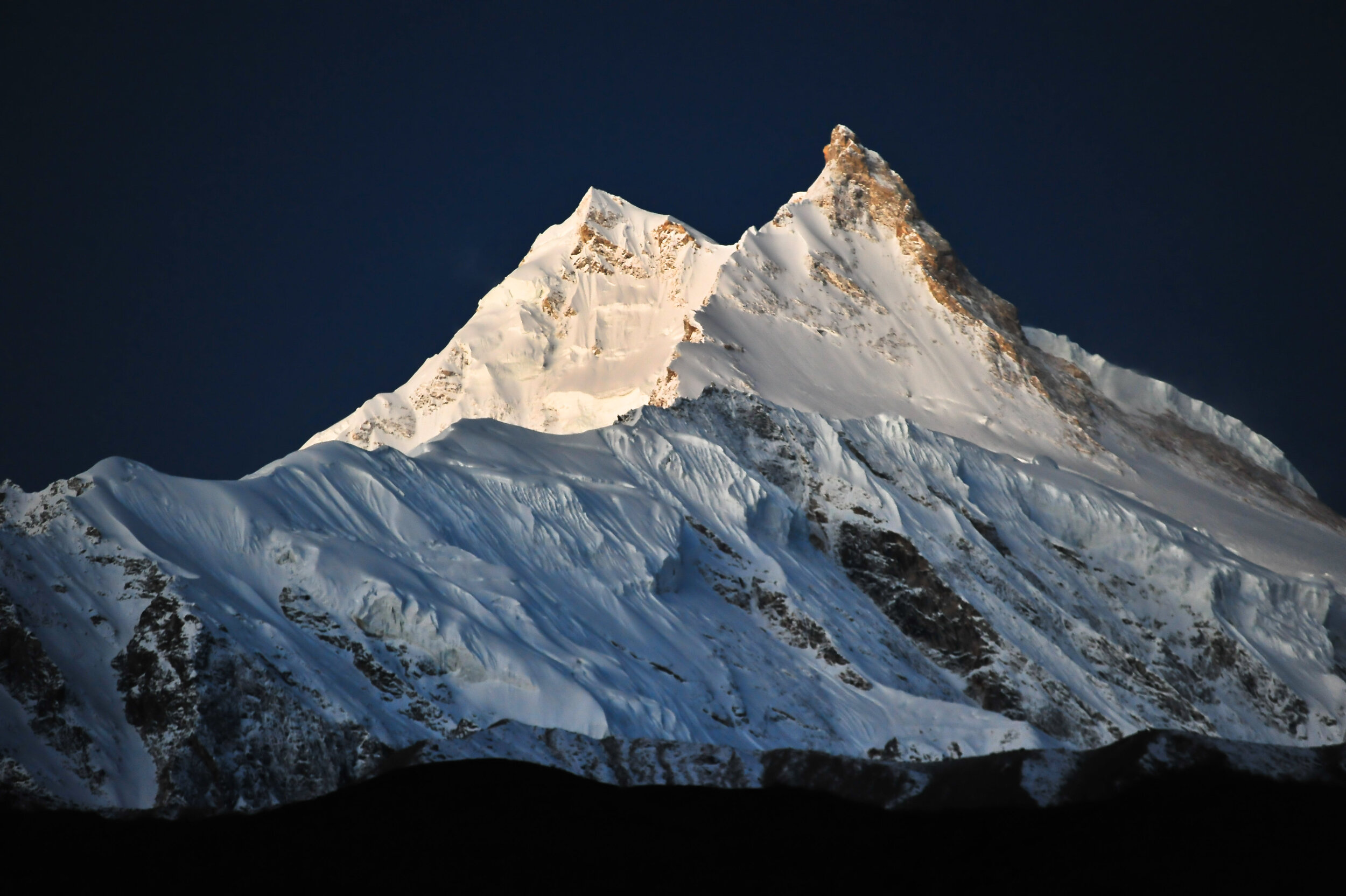
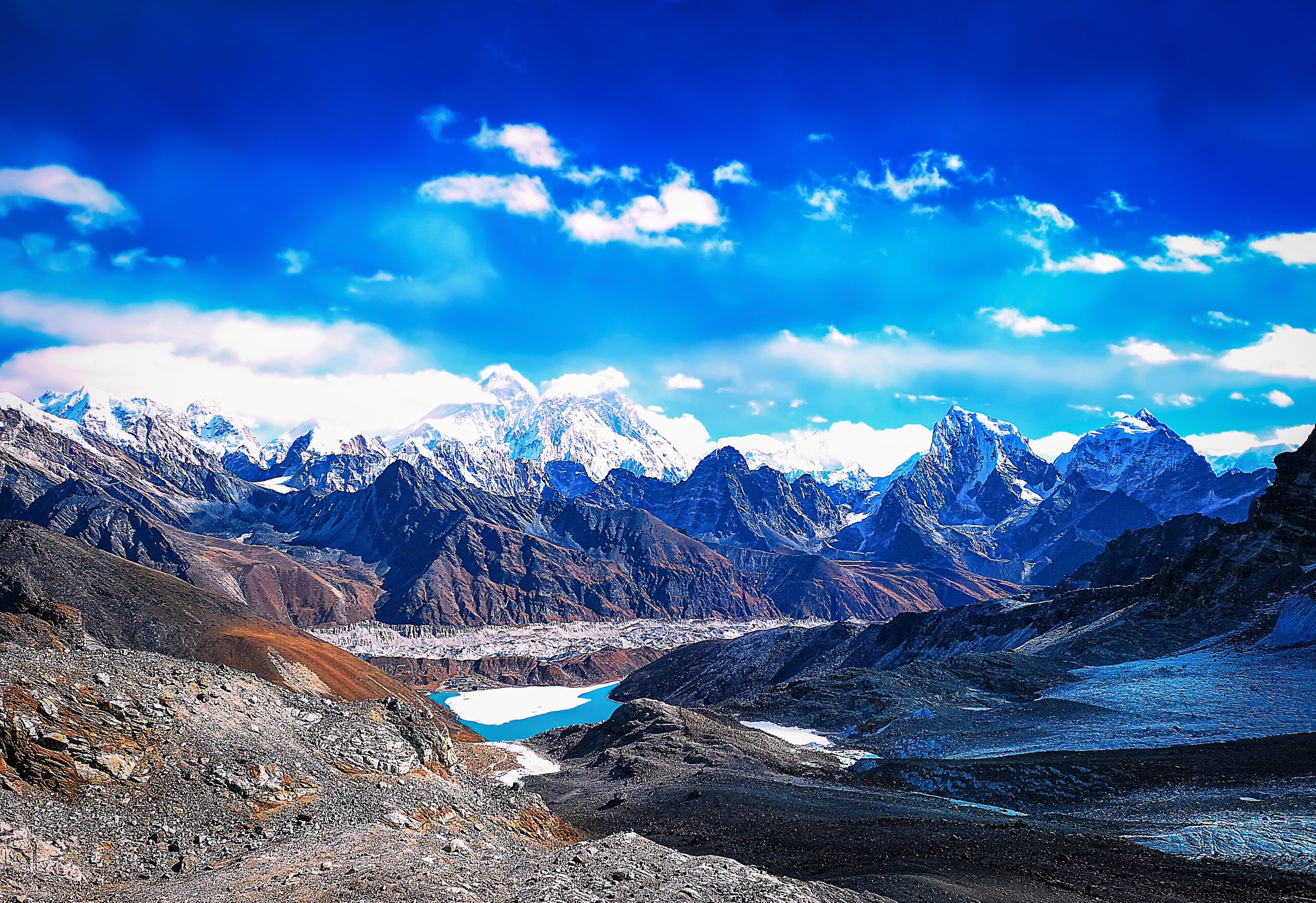
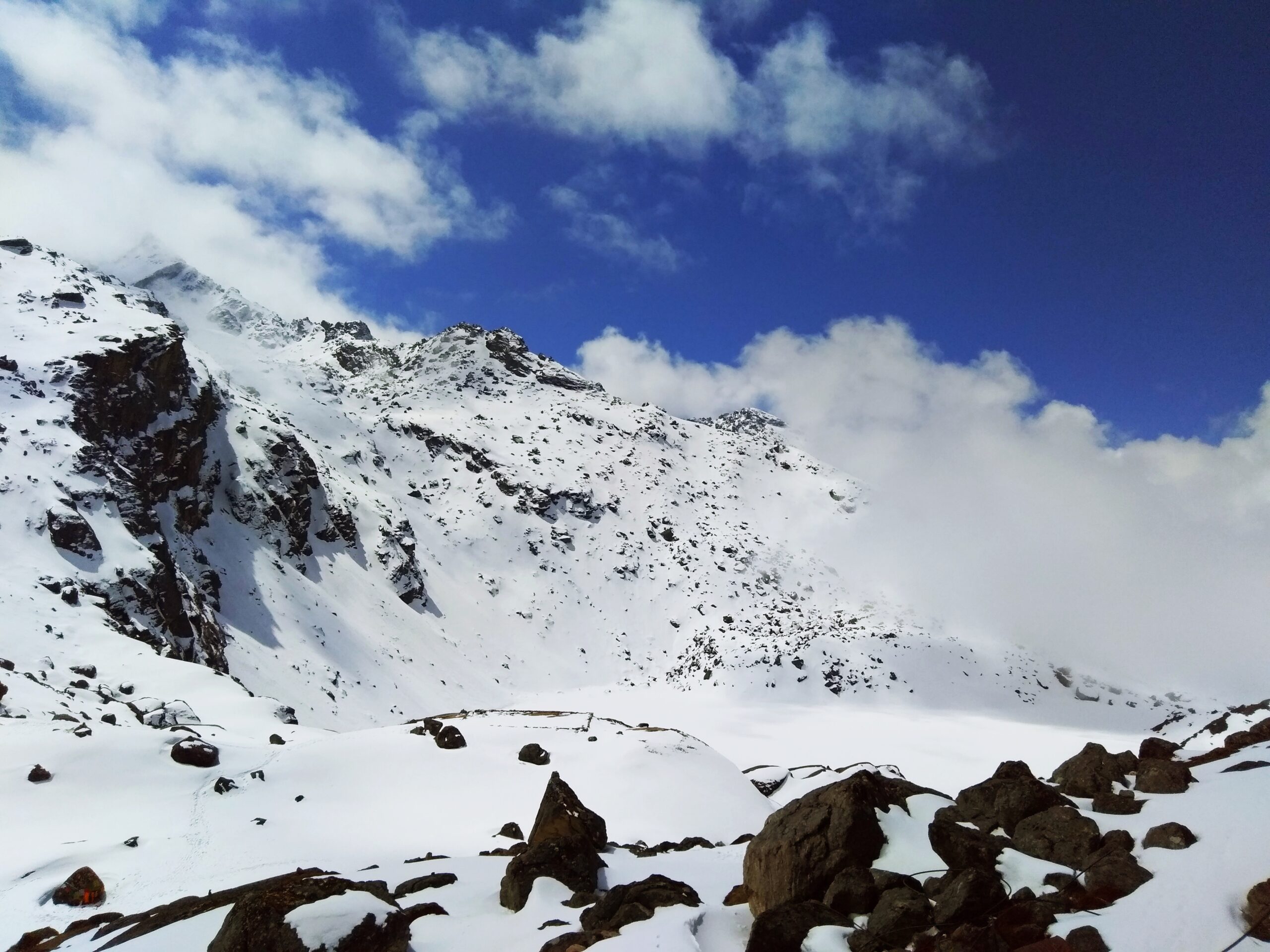
Very early morning wakeup call and start the ascent to Thorung la pass. We have to cross about twenty hills on the way to reach the summit, Thorong la, at 5,415 meters and it takes about 4 hours to reach the main pass from Thorung Phedi, but if we have spent the previous night at High Camp it will take appx 2~3 hours only. On the way up we get to see many prayer flags several cairns (small mounds of rock). From the top we get to see the Yakgawa Kang or Thorungse (6481m) to the north and Khatung Kang (6484) to the south and the Annapurnas along with the Gangapurna to the southeast.
In the horizon to the west, Dhaulagiri (8169m) and Mount Tukuche (6920m) are also visible. From the summit the descent to Muktinath (3802m) takes about three hours and the difference in altitude is of 1600m. Here we will find another check post where we have to show our trekking permits. Dinner and overnight at teahouse lodge.
Day 15
Trek to Marpha (2,667m / 8,750 ft) – 6 hours.
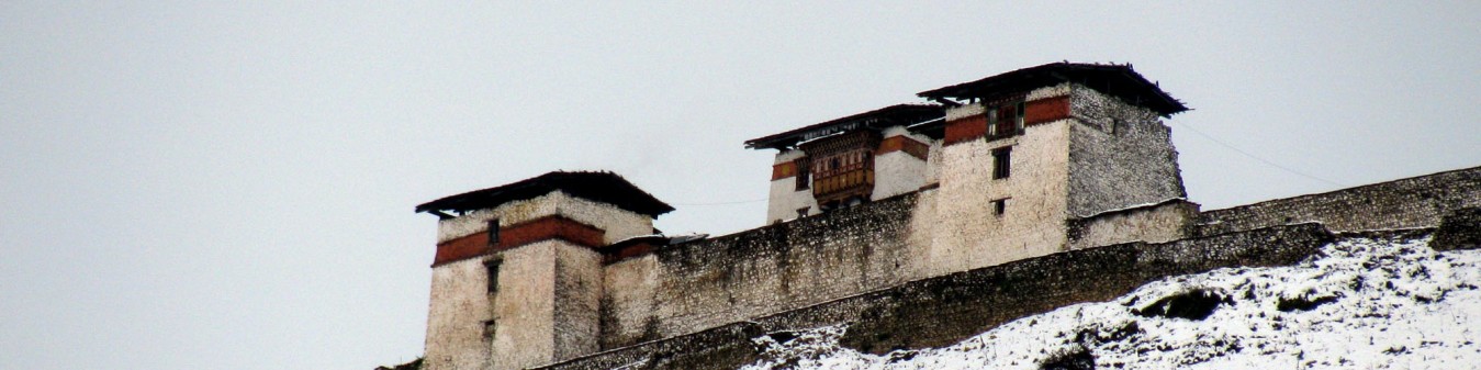
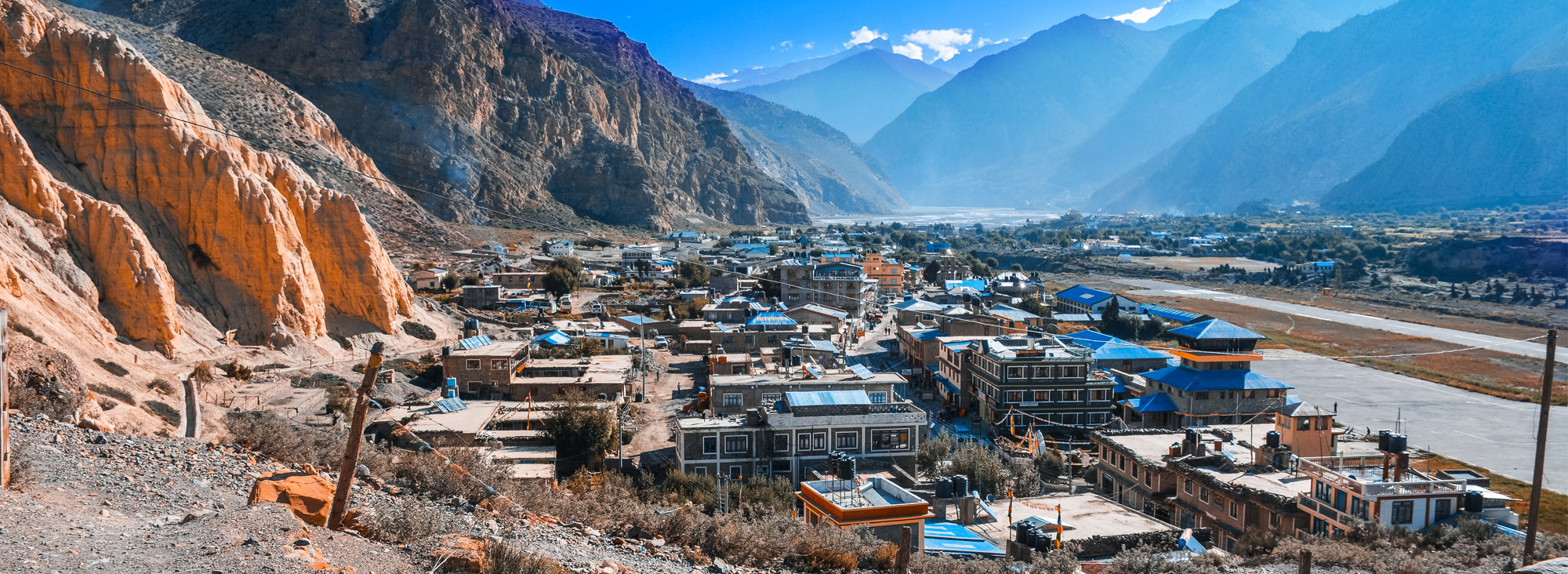
After crossing the hamlet of Ranipauwa, adjacent to Muktinath, we will reach the village of Jharkot(3612m), mainly populated by Tibetans. It takes about two hours through rocky terrain and horse caravans to reach Kagbeni (2807m) for lunch. It will take us about two –three hours to reach Jomsom (2713m) from Kagbeni, the administrative headquarters of the region. Here there is an airport with regular flights to Pokhara, a bank, post office, hospital and few hotels. From Jomsom continue to Marpha, which is famous for its apple liquor and it has a charm of its own with its black-salted streets and unusual architecture. Dinner and overnight at teahouse lodge or Camp.
Day 16
Trek to Ghasa (2,012 m / 6,600 ft) – 6 hours.
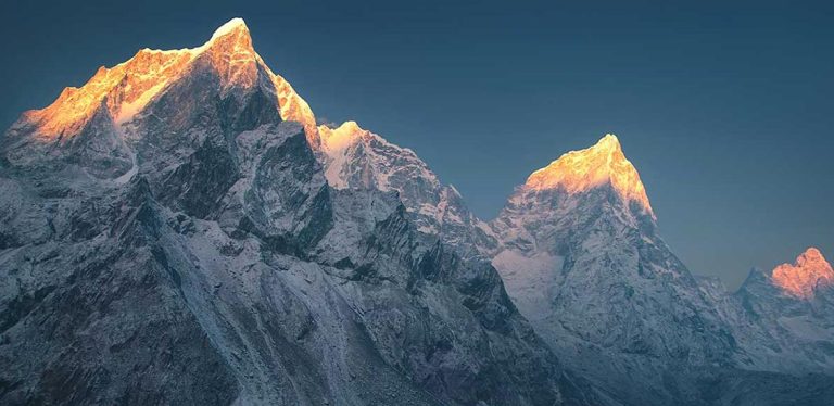
We start by walking along the bank of the river Kali Gandaki for an hour and half to reach the village of Tukeche (2951m), dominated by the name of the same peak, which stands at the height of 6930m. This beautiful village is populated by Thakalis, whose houses reflect just how significant this centre of Trans- Himalayan trade is. After Tukuche, the path meanders along the Kali Gandakhi valley for about one and half-hours to reach the village of Lajung (2560m). Outaide the village there is against pine where villagers sacrifice chickens and goats to propitate the Goddess Kali. The hamlet of Sokung (2951m) is another thirty minutes away. From here it takes about forty-five minutes to reach the hamlet of Dhampu. Here we have to cross the river to enter into Kalopani (or ‘black water’) located at 2530m.We will have lunch here and enjoy the impressive views of Dhaulagiri, the Nilgiris (South: 6839m, Central: 6940m and North: 7061m) and Annapurna I (8091m). From Sokung the path climbs up and down over a low altitude tropical forest to reach the village of Ghasa(2012m) which is two and half hours away. On the way we have to show our permits at the check post in the village of Lete (2,438m).
Dinner and overnight at teahouse lodge or Camp.
Day 17
Trek to Tatopani (1,189 m / 3,900 ft) – 6 hours.
It will take us about forty five minutes to reach the hamlet of Panoi Thaala and fifteen minutes from here we will reach Deorali, the boarder hamlet between the Mustang and Myagdi district. After crossing several hills from here, we start to descent until we reach the bridge leading to the west of the river. Few minutes walk from here will take us to the village of Rupse Chhara (1550m), near a huge a waterfall. We stop to have our lunch here. From Rupse it takes us about forty five minutes to reach the village of Dana (1446m), distinctive because of its large houses and decorative windows. From here it takes us about two hours easy descent to reach the camping place for the night, Tatopani (1189m). The names of the village means ‘hot springs’ for which the village is famous. Dinner and overnight at teahouse lodge or Camp.
Day 18
Trek to Ghorepani (2,874 m /9,427 ft) – 7 hours.
Today will be a hard day since we will cover a long distance with a difference in altitude of 1700 meters. From Tatoapni it takes two to three hours to reach the village of Ghara (1768m) and another hour to reach the village of Sikha (1920m) where we stop to have our lunch.
After lunch we climb through terraced cultivation’s, for about an hour and half to reach the village Chitre (2316m), and then across a rhododendron forest until Ghorapani, which is about an hour away. Ghorapani (2874m), means ‘water place for horses’ is, in fact, a stopover for donkey caravans travelling from Jomsom to Pokhara.
Dinner and overnight at teahouse lodge or Camp.
Day 19
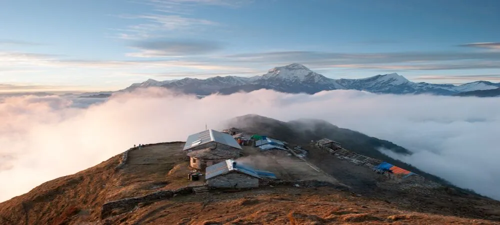
Hike to Poon Hill and descent down Hille (1,544) – 6 hours.
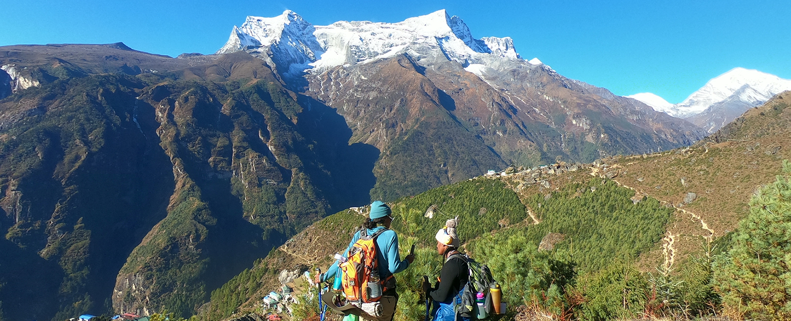
Pre-dawn alert and trek up to the Poon Hill (3,200m) to view a magnificent sunrise over the Annapurna Range. The views of the Annapurna and Dhaulagiri range are truly magnificent from Poon Hill. Shortly afterwards, return back to Ghorepani for breakfast.
After breakfast, we start by going through a subtropical forest for about an hour. Soon we will reach the village, Nayathanti (2450m), which is inhabited by the Magar tribe, traditionally recruited by the British army to serve the Gurkha regiment. From here it takes another hour to reach Banthanti (2250m). We stop here for lunch with Machapuchare (6993m) in the background. Nepalese regard Machapuchare or ‘fishtail’ as a sacred mountain because it is yet to be conquered. After Banthanti, the forest disappears only to be replaced by terraced cultivation’s that spread to the village of Ulleri, about thirty minutes away. Then we have to climb down a flight of steps for about two hours to reach the village of Hille (1524).
Dinner and overnight at teahouse lodge or Camp.
Day 20
Trek to Nayapul (3 hours) and drive to Pokhara (1& 1/2 hour.)
After breakfast trek to Nayapul it is about another 3 hrs to Nayapul. After bid farewell to all support Sherpa team and porters, meet waiting vehicle and drive to Pokhara. Upon arrival in Pokhara check in at a hotel.
Dinner and overnight at hotel.
Day 21
Sightseeing tour of Pokhara City and fly to Kathmandu.
After breakfast proceed for a sightseeing tour of Pokhara, which includes the visit of Bindabasini Temple, the Seti Gorge, Davis Fall. After sightseeing tour transfer to lakeside for lunch. After lunch transfer to Pokhara domestic Airport to board 25 minute flight to Kathmandu. Upon arrival in Kathmandu, meet waiting vehicle and transfer to hotel. Rest of the day till dinner is free for some rest and refreshment.
Eve: Farewell dinner at nice restaurant in Kathmandu. Overnight at hotel.
Day 22
Final departure from Nepal.
Free until final departure transfer to Kathmandu’s International Airport.
Got any question or Inquiries about the trip ?
In the morning after breakfast go for a walk and later return for lunch. After lunch the guest are free to rest.
Call our experts
+977-9851031177
Inclusions
Cost Includes
- All arrival/departure transfers, drives in a private vehicle with a/c accompanied by an English speaking tour representative/escort from Himalayan Holidays.
- The Annapurna Circuit Trek package in the Annapurna region inclusive of all meals (breakfast, lunch and dinner), accommodation in best available Teahouses/Trekkers Lodges, services of trained, trusted and highly experience trek Guides & Sherpa assistants including a team of strong and reliable porters.
- Annapurna Conservation Area Project (ACAP) fee.
- Trekking Information Management Service (TIMS) fees.
- All meals as listed on the above Itinerary.
- Single Room supplement for a single solo cameraman.
- Sherpa team return supplement that includes; meals, accommodation and transportation.
Cost Excludes
- International airfares and airport departure taxes.
- Nepal entry visa fees.
- Airfare for sector Pokhara / Kathmandu quoted separately.
- Any lunches in Kathmandu.
- Hiring charges for Sleeping bags and down jackets.
- Items of personal nature such as bar bills, telephone calls, laundry, drinking water, extra mileage and any extra costs incurred due to natural calamities, flight delays etc.
- Comprehensive Travel Insurance or “Umbrella Insurance” to cover – Illness, hospitalization, travel medicines, loss of valuables, thefts change of itinerary, flight and tour cancellations due to unavoidable circumstances and most of all Emergency Helicopter Charter for evacuation.
- Quoted Single supplement rates are only for accommodation in Kathmandu.
- Items not specified in the above in “costs include column”.
Availability
Book this trip with us from the following dates. For Custom Trips or general inquiries, Contact Us.
Departure Date
Availability
Action
Dec 07 (Thursday)
49 Slots left
Click to Book
Dec 08 (Friday)
20 Slots left
Click to Book
Dec 09 (Saturday)
50 Slots left
Click to Book
Dec 10 (Sunday)
100 Slots left
Click to Book
Dec 11 (Monday)
200 Slots left
Click to Book
Frequently Asked Questions
Nepal visa is easily issued from Nepalese Embassy in your country. Nepal also issue on arrival visa for 15 days, 30 days and 90 days charging fee of USD 25, USD 40 and USD 100 respectively. Please carry two passport size photos along with you.
Best season for trekking in Nepal is from March to May and September to November. During this time weather is clear and warm. But, if you like to avoid crowd then best time for your trek will be from May to September.
Yes, we do provide international airport pick up and drop off services. Outside terminal, our staff will be displaying companies play card or your name card depending upon group size, for your convenience.
It is compulsory to have your insurance before you visit Nepal. For trekking and Alpine Climbing you must have High Altitude Insurance. And for Tour and sightseeing you must have travel insurance.
You must be physically fit and healthy for trekking in Nepal. It’s better to do at least 2 hours morning or evening walk to prepare yourself for this trekking. Please let us know in advance if you have any medical problems like heart disease, asthma and blood pressure.
Difficulty level depends upon the remoteness and altitude of the trekking route. Basically, trekking below 3,000m is easy. Higher the altitude, it’s more difficult to walk.
In trekking, wide variety of food is available. Teahouses prepare Nepali food, Indian food and Continental food as per menu. All the foods are freshly prepared. We suggest you not to consume meat items during the trekking.
Basically, we accommodate our clients in 3 to 4 star hotel in Kathmandu, Pokhara, Chitwan and other major cities in standard rooms on twin sharing basis. For luxury package we accommodate you in 5 star and beautiful boutique hotels in available places. On trek we accommodate you in best available lodges and teahouses standard rooms on twin sharing basis and occasionally dormitory on busy season.
In teahouse trekking basic facilities are available, with clean rooms, blankets, freshly cooked warm food. Sometimes there will be common toilets and bathrooms outside your room. Warm water is available for shower on extra cost.
In camping trekking, we will use the tents that can keep us warm from -20 degree Celsius to -40 degree Celsius. Tents for toilet, shower, dinning and kitchen will be set up for your convenience. Comfortable trekking chairs, tables and mattress will be available. Fresh and healthy food will be prepared by our professional cook.
Means of transportation depends on places you travel. We have our own fleet of transportation like car, jeep, Hiace and Coaster tourist bus for ground transfer. Domestic airplane and helicopter are used for air transportation.
Weather in the Mountains is highly unpredictable. So we should always be prepared to tackle the cold. From March to May and September to November in the morning and evening temperature will be (from 3000m to 6000m) 0 degree Celsius to 5 degree Celsius, in afternoon it will rise upto 20 degree Celsius to 25 degree Celsius and at night it might fall down till -5 degree Celsius to -10 degree Celsius. Similarly, during winter i.e. December, January and February there will be heavy snowfall in the Mountains dropping temperature till -15 degree Celsius at night. Morning and evening will be around -5 to 5 degree Celsius and temperature will rise upto 15 degree Celsius during day time. And our monsoon season from June to August where we expect heavy and continuous rainfall. But if we go above 3000m altitude ratio of rainfall will decrease. Temperature during day will reach upto 25 degree Celsius high and reduce till 0 degree Celsius to -5 degree Celsius. Morning and evening will be chill from 5 degree Celsius to 15 degree Celsius.
For trekking in the Mountains you will need very warm, windproof, waterproof clothes. You must bring trekking/hiking boot which is comfortable to wear and walk. Beside that quick dry t-shirt, trouser and towel is important.
On average you have to walk 6 to 8 hrs a day covering 12 to 18 km in distance.
Of course, this trip is completely safe for solo travelers. You will have your guide and porter for your assistance; they will definitely take care of you along the trip.
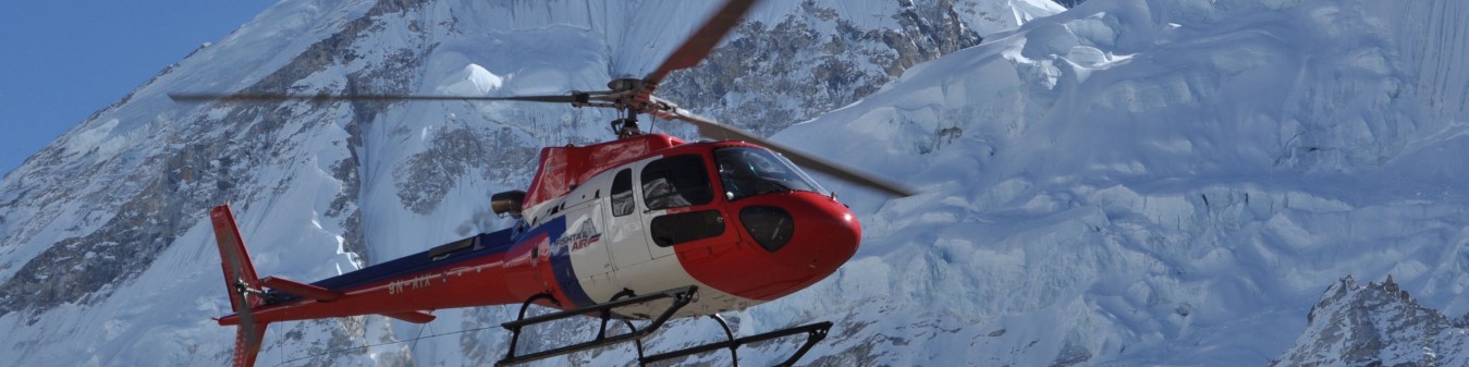
Health and safety of our clients is a major concern of our company. All our guides have got first aid training. Your guide will be carrying first aid kit and satellite phone during the trekking in case of emergency and we can use the helicopter service for immediate evacuation.
Yes, you can use your debit/credit card in major cities like Kathmandu and Pokhara. We suggest you to carry cash (Nepali Currency) during the trekking for your personal expenses.
If its Altitude Sickness problem then we will immediately carry you down to lower altitude. We will take you to the nearby health post and if the case is serious we will immediately do helicopter rescue and admit in major hospitals in Pokhara or Kathmandu.
We have included rest/spare day in your itinerary to acclimatize in the thin air. Your guide will encourage you to drink more soup and garlic which is believed to help in high altitude. Besides that, your guide will be carrying medicine (Diamox) to reduce altitude sickness.
Book this Trip
4.1 (158 reviews)